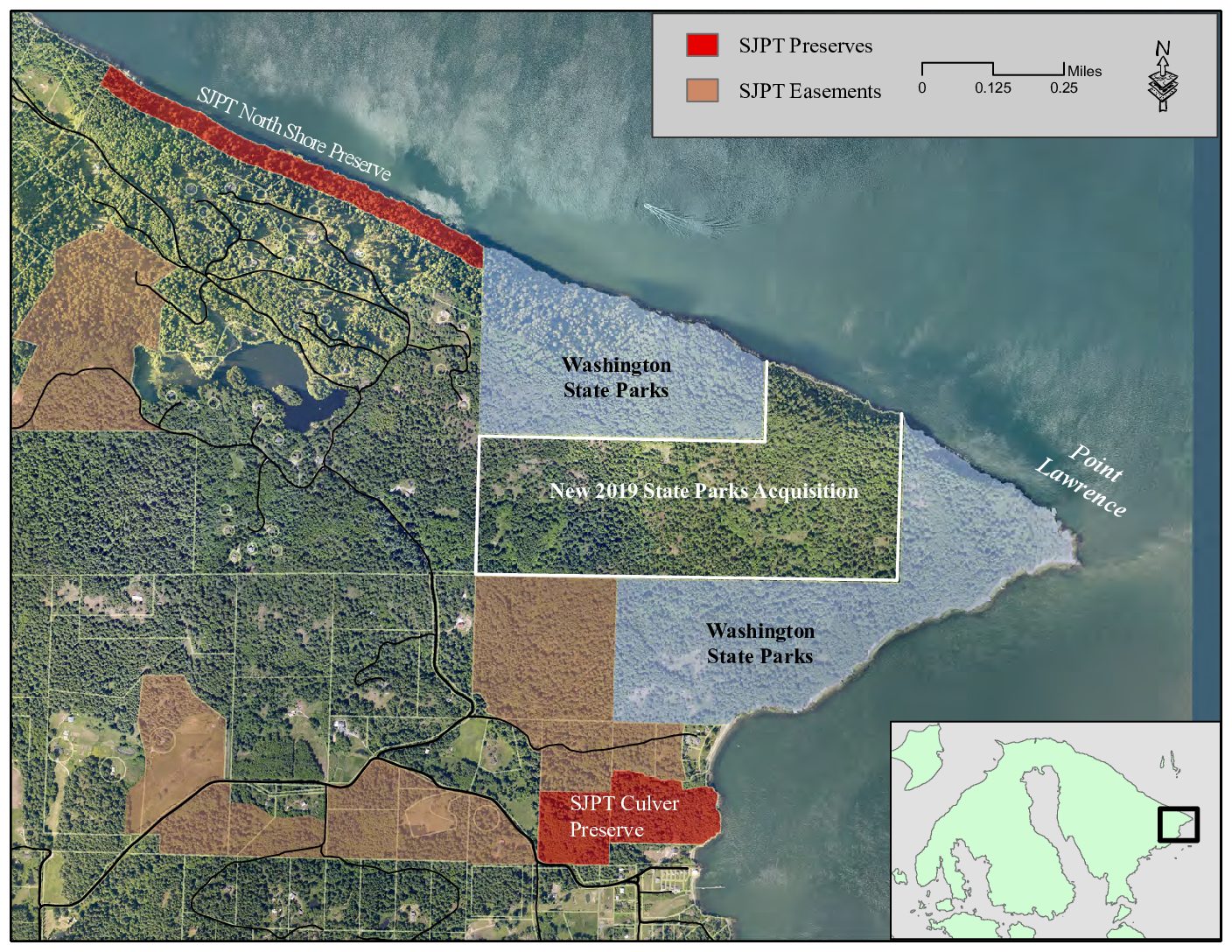
This map shows conservation lands on Orcas Island’s Point Lawrence
We were pleased in November 2019 when Washington State Parks and the Alberg and Johanson families announced the state’s purchase of the 134-acre Point Lawrence property at the easternmost tip of Orcas Island. “This is a really great acquisition,” said SJPT Stewardship Director Dean Dougherty. “Not only does it connect two state shoreline properties, but our Northeast Shore Preserve and the Point Lawrence conservation easement are also contiguous. All together, there are now 400 protected acres with three miles of shoreline.”
Not quite contiguous, but also in the neighborhood, are the Preservation Trust’s Culver Preserve (with 800 feet of shoreline) and additional conservation easement properties. The map above shows all the pieces.
Quoting from the joint announcement regarding the 134-acre State Parks acquisition:
The property originally was purchased by Thomas Alberg, Sr, and Alvin Johansen in 1960. The previous owner homesteaded the property in 1908. Tom Alberg, son of Thomas Alberg, Sr., said: “Our families are delighted that the properties will now be open to the public and preserved in perpetuity for Orcas residents and visitors to enjoy.”
The property is home to wildlife, trees (fir, cedar, hemlock, broadleaf maple, madrona) and vegetation such as foxglove, wild blackberry and salal. There is a meadow where the remnants of the original homestead are located and two ponds.
While the state properties may have pubic access in the future, the Preservation Trust will continue to manage our preserves mainly for the benefit of wildlife.
Point Lawrence is a relatively undeveloped area, thanks to its remoteness, and is a prominent feature for mariners navigating on Rosario Strait between Orcas and Lummi Islands. Permanent protection of lands on and surrounding the point is an important legacy that adds significantly to conservation of the wild, rugged character of the San Juans. You have contributed to that legacy with your support—thank you!
