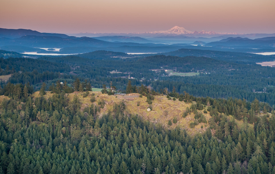
Mount Grant Preserve
San Juan Island
Year Protected: 2015
Land Protected: 141 acres
Public Benefits: Scenic views, diverse forest, meadows, trails, drive-up access
Conserved jointly by the San Juan County Conservation Land Bank (owner/manager) and the San Juan Preservation Trust (easement holder)
The ridgeline and surrounding hillsides of Mount Grant cover 141 acres, with diverse forest, including old-growth Douglas-fir. The property hosts several habitat types as well as species that are listed among Washington State’s priorities for protection, including the pileated woodpecker, band-tailed pigeon, and bald eagle, as well as a multitude of other bird and bat species. Grassy bald areas nurture a rich variety of wildflowers, including Henderson’s shooting star, great camas and fawn lily. Mount Grant is adjacent to the Town of Friday Harbor’s Trout Lake watershed, which serves as the town’s primary source of fresh water.
Perhaps the most striking feature of this parcel is the summit ridgeline of Mount Grant, which can be accessed via an existing road that terminates at a wide clearing. From this area, visitors can gaze northeast to Mount Baker and the Twin Sisters, southeast down into San Juan Valley and Lopez Island, and north/northwest to Stuart Island and beyond to the Canadian Gulf Islands. The 360-degree view is spectacular.
Prior to its purchase by a partnership between the Preservation Trust and the San Juan County Land Bank, the Mount Grant property was on the market as a private housing development under the name “Lawson Ridge.” It had been subdivided into twelve 10- to 20-acre lots with supporting roads, driveways, water system and utilities. Cleared and graded building sites had been carved into the hillside. These twelve building lots had been listed for a combined total of $4.135 million, but we negotiated a purchase price of $3 million for the entire property.
In January 2017, the Preservation Trust announced the successful completion of the $4.2-million Campaign for Mount Grant Preserve, which included funds for the acquisition of the property, plus restoration of disturbed plant and wildlife habitat, trail-building, signage and other visitor amenities, maintenance of the existing road, and long-term stewardship of the preserve. The San Juan County Land Bank now owns and manages the preserve, while the Preservation Trust holds a conservation easement that ensures that the 141-acre property will remain a publicly accessible nature preserve in perpetuity. The Land Bank began a process of soliciting community input that would guide the creation of a restoration and management plan, future trails, driving access, and other activities.
Recent research by local historians has shown that, in the mid-19th century, the 640-foot-high ridgeline and surrounding slopes had been mapped as “Mount Grant.” The name disappeared from an 1890 map, reappeared in a geologic report in the 1920s, and then was lost again. Most likely, the ridge was named after Ulysses S. Grant, general of the Union Army during the Civil War and U.S. president from 1869-1877.
Mount Grant Preserve is open to the public. Click here for visitor information and trail map.

